Hustai National Park Map and Orientation
Once you understand how the park is laid out, a day here stops feeling like a mystery and starts feeling like a plan.
 Written with Bat-Erdene Ganbaatar, Hustai National Park tour guide and wildlife specialist
Short answer
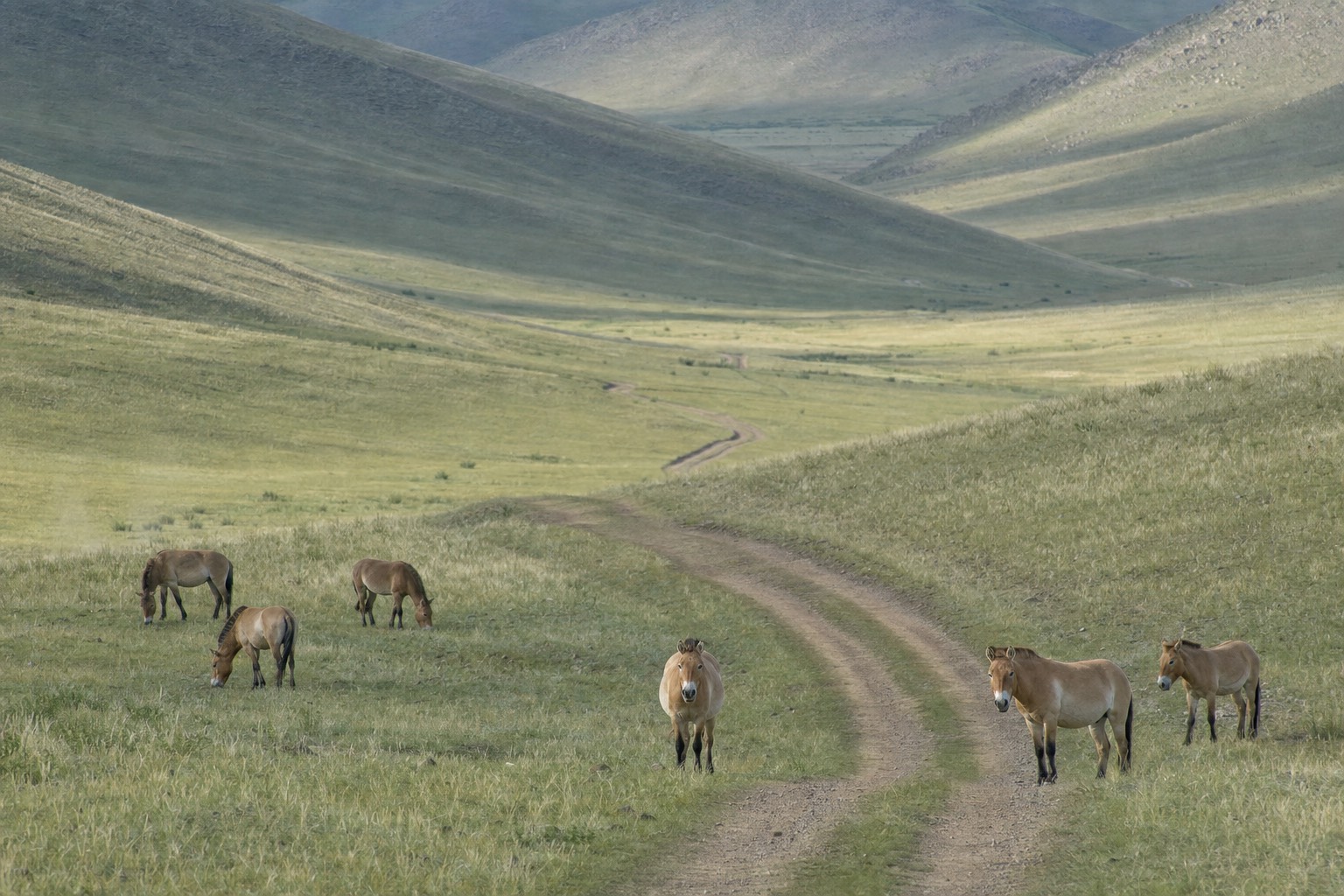
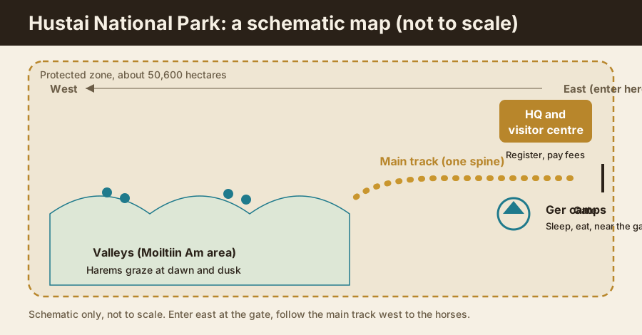
Hustai is simple to picture: you enter from the east, where the headquarters, visitor centre, and ger camps cluster at the gate, then follow one main track west into the valleys where the wild horses graze. The park covers roughly 50,600 hectares. Register and pay fees at HQ, then let a guide take you toward the Moiltiin Am area for dawn and dusk sightings.
Booking Choice: Enter Hustai from the east. Check your date for a private 8 to 10-hour visit before arranging separate transport, admission and lunch. Check private Hustai dates
People often expect a national park to be a maze of trails and signposts, and then they reach Hustai and find something much simpler. There is one gate, one main track, and a lot of open steppe folded into shallow valleys. I have driven it hundreds of times, and the layout is easy to carry in your head once someone sketches it for you. That mental map is half of what makes a visit here relaxed rather than anxious.
Discover private hustai wildlife day with the main travel logistics arranged around the experience described here. Explore the private Hustai wildlife visit
TL;DR: Enter Hustai from the east. The headquarters, visitor centre, and ger camps all sit near the entrance, where you register and pay. From there a single main track leads west into the valleys, including the Moiltiin Am area, where the harems tend to appear at dawn and dusk. The park spans roughly 50,600 hectares, but the part you actually move through is compact and linear.
What does Hustai National Park look like on a map?
Picture a wide protected area entered from its eastern edge. The gate, headquarters, visitor centre, and ger camps cluster together at the entrance. From there, one main track runs westward into a series of grassy valleys where the wild Przewalski's horses graze. You register at HQ, then travel the track with a guide toward the valleys. Everything keys off that single east-to-west line.
The park protects roughly 50,600 hectares, or about 506 square kilometres, of the Khustain Nuruu range, the Birch Mountains. That sounds vast, and the protected zone is, but visitors do not roam all of it. You experience a linear corridor: in at the east gate, along the main valley track, out the way you came. The official Hustai National Park site frames the reserve around this core visitor area and its wildlife, and the Hustai National Park Wikipedia entry gives the same broad geography.
Hold that shape in mind and the rest of this guide slots into it. HQ at the gate. Camps at the gate. One track. Valleys to the west. Horses in the valleys. That is the whole map in a sentence.
Where are the headquarters and visitor centre?
The park headquarters and visitor centre sit right at the eastern entrance, and this is your first stop. You register here and pay the entrance and vehicle fees, and it is where a park guide joins wildlife drives into the protected zone. The visitor centre also holds the exhibits explaining the takhi reintroduction, worth ten minutes before you head in.
Think of HQ as the hinge of the day. Nothing wildlife-facing happens before you have stopped here, because the protected zone beyond needs a guide and a paid ticket. Both of the guided day options that go to Hustai fold the entrance fees into their price, so on an organised day you may barely notice the transaction, but the stop still happens. If you are self-driving, this is where you sort out permission and pick up the required guide.
The visitor centre earns its ten minutes. The exhibits lay out how the takhi came back from extinction in the wild, which turns the horses you see later from pretty animals into the ending of a real conservation story. For the numbers behind that recovery and the other species you might spot, the animals in Hustai National Park guide goes further.
How is the park laid out beyond the gate?
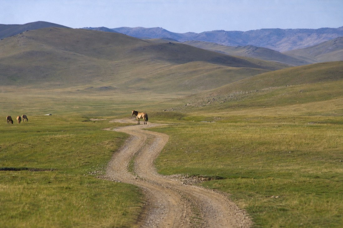
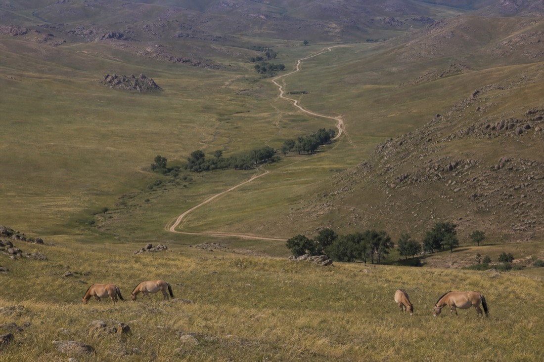
Past HQ, a single main track leads west into the valleys that form the heart of the visitor area. It threads between low grassy hills toward the Moiltiin Am area and the neighbouring valleys where harems graze. There is essentially one spine to follow, not a web of trails, so getting lost is not really a risk. Your guide reads the side valleys off that main line.
This is the part that surprises first-timers. You are in a huge reserve, yet the driving is straightforward: follow the track, watch the valleys open on either side, stop where the guide spots movement. The Moiltiin Am area is one of the valley zones the guides work, and in my experience the harems favour these sheltered valleys where grazing and water sit close together. The animals move, so no two days trace exactly the same route, but the spine of the track stays the same.
Because the layout is linear, orientation is mostly about direction and light rather than trail-finding. You want to know which way is west, where the sun will sit at dawn or dusk, and which valleys the guide is heading for. Get those and you always know roughly where you are.
Key locations and what happens at each
| Location | Where it sits | What you do there |
|---|---|---|
| Entrance gate | Eastern edge | Enter the park, start of the visit |
| Headquarters and visitor centre | At the gate | Register, pay fees, see exhibits, meet guide |
| Ger camps | Near the entrance | Sleep, eat, base for dawn and dusk drives |
| Main track | Runs west from HQ | The single route into the valleys |
| Moiltiin Am and valley zones | West, along the track | Prime wild-horse viewing areas |
| Open steppe between valleys | Along the track | Marmots, red deer, gazelle, birds of prey |
Where are the ger camps?
The ger camps sit near the eastern entrance, close to the headquarters rather than deep in the park. The park's own Hustai Nuruu Ger Camp has 35 gers and can host up to 100 guests, and a second camp, Hustai Resort, runs year-round with standard and deluxe gers. Staying at the gate puts you minutes from the main track for the dawn and dusk drives that give the best sightings.
The logic of camping at the gate is timing. Harems come down to graze in the soft light around dawn and dusk, and the visitors who see the most are the ones who can roll onto the main track early, before the day-trippers arrive from the city, and again in the evening after most have left. An overnight at a gate camp buys you both of those windows in a way a single-day drive from Ulaanbaatar cannot.
If you are weighing a night in the park against a long day trip, the where to stay at Hustai guide lays out the camp options and what a ger night is actually like. Either way, the camps anchor to the entrance, so they slot neatly into the east-gate mental map.
Where do the wild horses appear?
The harems tend to appear in the western valleys along the main track, coming down from the higher ground to graze at dawn and dusk. In my guiding experience the Moiltiin Am area and its neighbouring valleys are reliable places to scan, though the horses move daily and nothing is guaranteed. Midday, they often retreat to higher, cooler ground and are harder to find.
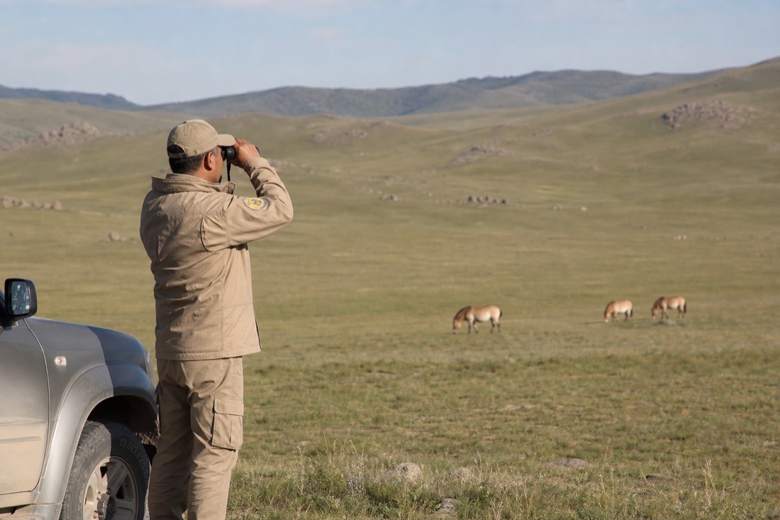
This is where the mental map pays off. Knowing the horses favour the western valleys at the low-light hours tells you both where to look and when. I position guests uphill and downwind of a harem when I can, so we watch without pushing the animals, and I keep us to the track. The distance rule of roughly 200 to 300 metres is not just etiquette; it is what keeps the harem calm enough to stay in view.
Sightings are strong at Hustai but never certain, and honesty matters more than hype here. Some days the horses are close to the track at first light; other days you glass distant harems on a far slope. To shape the hours around the best odds, pair it with the one day in Hustai itinerary.
How big is the park, and how far apart is everything?
Hustai covers roughly 50,600 hectares, and the drive from Ulaanbaatar to the entrance is about 100 km, or 1.5 to 2 hours on paved road with a short gravel approach. Inside the park the distances are much shorter: the ger camps and HQ sit together at the gate, and the main viewing valleys are a modest drive west along the track. In my experience it is minutes, not hours, from the gate to the first valleys.
The scale is worth separating into two parts. The long haul is getting to the park at all, and that is the drive from the city. Once you are through the gate, the visitor area is compact, which is why a well-run day feels unhurried despite the early start. The times inside the park below are my rough guiding estimates rather than official figures; traffic, weather, and where the horses are will shift them.
| Leg | Distance or time | Notes |
|---|---|---|
| Ulaanbaatar to entrance | About 100 km, 1.5 to 2 hours | Paved road, short gravel approach |
| Entrance to HQ and camps | At the gate | Clustered together, minimal driving |
| HQ to first viewing valleys | A short drive west (roughly 15 to 20 min, my estimate) | Along the main track |
| Between valley viewing spots | Minutes | Guide moves you as horses shift |
| Whole park end to end | Large protected zone, ~50,600 ha | Visitors use a linear corridor, not all of it |
A short set of orientation habits keeps the day smooth. These are the things I tell guests before we roll through the gate.
| Orientation tip | Why it helps |
|---|---|
| Stop at HQ first | Register and pay before anything else; it is required |
| Fix which way is west | The horses' valleys lie west along the main track |
| Plan around dawn and dusk | That is when harems come down to graze |
| Stay on the main track | There is one spine, so you will not get lost |
| Keep 200 to 300 m from horses | Distance keeps the harem calm and in view |
| Base at a gate camp for two windows | Nearness to the track buys both dawn and dusk drives |
For the door-to-door logistics of reaching the gate in the first place, the how to get to Hustai from Ulaanbaatar guide covers transport options, and the best time to visit Hustai guide explains why the season shapes the light and the sightings.
What does the first two hours inside the park actually look like?
The first two hours follow a simple sequence: register and pay at headquarters, meet your guide, drive the short stretch west to the main track, and reach the first valley where harems are commonly scanned. None of it is complicated, but knowing the shape of it in advance turns an unfamiliar stretch of steppe into a plan you can follow along with rather than simply endure.
Most first-time visitors arrive expecting either a long wait or an instant sighting, and the truth sits between the two. The opening minutes are administrative rather than scenic: queueing at the desk, paying fees, picking up whatever orientation material the visitor centre has out that day. That part takes less time than people brace for, usually under half an hour even when a coach group is ahead of you. What follows is the part worth savouring, a steady westward drive where the steppe opens out and the day's actual purpose begins.
By the ninety-minute mark on a good day, you are in a valley with your guide reading the terrain, and the first realistic sighting window is open. It will not always deliver a harem in the first two hours, wild animals do not run to a clock, but the sequence itself, gate to valley, holds steady regardless of what the horses are doing that morning.
Two things catch people off guard in this window. The first is how quiet it gets once the engine cuts for a scan, a stillness that surprises visitors coming from a busy city. The second is how much closer the hills feel once you are actually among them than they looked from the gate, where the whole valley system reads as one flat expanse of steppe. Neither is a problem, both are simply part of what the first two hours teach you about the place.
| Elapsed time | Where you are | What is happening |
|---|---|---|
| 0 to 15 minutes | Park headquarters | Register and pay entrance and vehicle fees |
| 15 to 30 minutes | Visitor centre | A brief look at the reintroduction exhibits, guide assigned |
| 30 to 50 minutes | Main track, heading west | Open steppe on both sides, no stops yet |
| 50 to 80 minutes | First valley zone | Guide scans for harems, the first real sighting window |
| 80 to 120 minutes | Moiltiin Am or a neighbouring valley | A second scan, closer approach if a harem has settled |
What are the landmarks along the route, and what is each known for?
Beyond headquarters, the main track, and the ger camps already covered, three stops give the route its character: an ancient burial site travellers mention in their reviews of the drive, a herder family's ger where several tours pause for food and conversation, and the marmot burrow fields that line the open steppe between valleys. None of these need a detour, they sit along the route you are already following.
The ancient burial site comes up often enough in traveller accounts that it is worth flagging as a real stop, not folklore. One recent Viator review of the private tour describes moving "over the Hustai Park to spot the wildlife and visit an ancient burial site," a quiet, unmarked kind of landmark rather than a monument with a car park. The herder family stop is better known: both featured tours build in time with a local family, and reviewers consistently mention it as a highlight, drinking milk, watching herding, and simply sitting in a ger that is someone's actual home rather than a display. One GetYourGuide reviewer described it as one of the most memorable moments of "50-nation travels," which tells you the stop competes with the horses themselves for the best memory of the day. The marmot fields are the one landmark you will not need pointed out. Siberian marmots are genuine ecosystem engineers here, and a 2024 field survey counted thousands of burrows across the park, many of them active, so the pockmarked ground itself becomes a landmark once you know to read it that way.
None of these three stops are marked on any signage, and that is deliberate. Hustai is a working reserve first, not a curated sightseeing route, so its landmarks tend to be things your guide points out as you pass rather than a fixed itinerary printed on a board.
| Landmark | What it is known for |
|---|---|
| Ancient burial site | A quiet, unmarked historical stop mentioned in visitor reviews of the drive |
| Herder family ger | A pause for food, milk, and conversation with a working nomadic family |
| Marmot burrow fields | Dense, active burrow networks along the open steppe between valleys |
| Birch stands in the valleys | The birch that gives Hustai its name, visible in the sheltered valley floors |
How do you avoid getting turned around on the single track?
You will not lose the track itself, since Hustai runs on one main spine rather than a web of trails, but the valleys along it can start to look alike after the third or fourth stop. The fix is to fix a handful of visual anchors early: the direction of the morning sun, the birch stands marking certain valleys, and which vehicle in your group to follow if the party splits to view different harems.
The confusion people actually report is not "which way is the gate" but "which valley is this one again", after an hour or two of similar grassy folds sliding past the window. A simple habit solves it. Note the sun's position against the track soon after you set out; since the route runs broadly east to west, the sun stays a rough compass all morning and again in reverse on the way back. Birch stands, the very trees that give the park its name, cluster unevenly rather than everywhere, so a valley with visible birch on its slopes is a genuine, memorable marker against one that is bare grass. And if your group's vehicles separate to follow different harems, agree with your guide beforehand on where and roughly when you will regroup, since radios and phone signal both thin out once you are deep in the valleys.
This is also where trusting the guide fully pays off. Self-driving visitors sometimes try to keep a running mental map of every turn, which is a habit built for cities and does not suit a park with a single spine. Let the track do that work for you. Your only real job is noticing the handful of anchors above, not memorising the whole route turn by turn.
| Landmark cue | What it tells you |
|---|---|
| Sun ahead of you in the morning | You are heading correctly west along the main track |
| Birch stand on a valley's slope | A specific, memorable valley rather than an anonymous one |
| Headquarters behind you, out of sight | You have passed the point where mobile signal starts to thin |
| Your guide's vehicle position | The fixed reference if the group splits to view separate harems |
The orientation habit Bat-Erdene gives every guest on arrival
Guiding Hustai since 2022, past a thousand travellers by my own count, the one habit I try to instil before we even leave headquarters is simple: look back at the gate before you look forward at the valleys. Knowing what your fixed point looks like, so you would recognise it from a distance, does more for a relaxed day than any map I could hand out.
New guests want to fix the valleys in their mind first, which is the wrong order. The valleys shift, in light, in which harem is where, in how the grass moves in wind, and no amount of memorising will make today's view match tomorrow's. The gate does not shift. It is the one stable thing in the whole layout, and a visitor who can picture it clearly, however far out the day takes them, never actually feels lost, only unfamiliar, which is a much easier feeling to sit with. The mistake I see most, especially with confident first-timers who skip this, is a mild but real anxiety creeping in by the second valley, a feeling of having come too far from anything known. Fix the gate first, and that feeling mostly does not arrive at all.
I picked this habit up the hard way, watching a handful of early guests grow visibly tense once the gate dropped out of sight behind the first ridge, even though nothing about their safety had changed at all. A thirty-second look back before we set off, so everyone has that image fixed, costs almost nothing and has quietly become the first thing I do with every group since.
Common questions
Is Hustai easy to navigate on your own?
The layout is simple, one main track from the eastern gate into the western valleys, so you will not get lost. However, a park guide is required for wildlife drives in the protected zone, so you cannot simply drive to the horses unaccompanied. Register at HQ first.
Where exactly do you see the wild horses?
In the western valleys along the main track, including the Moiltiin Am area, especially at dawn and dusk when harems come down to graze. Midday, they often move to higher, cooler ground. The animals shift daily, so a guide's read of the valleys makes a real difference.
How far is it from the gate to the horses?
Not far. The HQ and camps sit at the eastern entrance, and the main viewing valleys are a short drive west along the track, roughly 15 to 20 minutes in my experience. The long part of the journey is the 100 km drive from Ulaanbaatar to the gate, not the driving inside the park.
Is there a printed map at the park?
The visitor centre at HQ has orientation material and exhibits, and your guide knows the valleys intimately. Because the park runs on a single main track rather than a trail network, you mostly need direction and timing rather than a detailed trail map.
Choose Your Next Step
Private Hustai Wildlife Day
Have your travel date in mind? Check Private Hustai Wildlife Day before arranging the rest of your trip.
8 to 10 hours. Private transport, lunch and park admission; pickup offered from Ulaanbaatar. English, French, Korean or Russian. Wildlife and a dawn departure are not guaranteed. Not wheelchair accessible; not recommended during pregnancy.
Compare Trip Styles And Adjust Your Choice
- Six-Hour Hustai Day: About 6 hours. Downtown Ulaanbaatar hotel transfers, local lunch, entrance and an English- or Mongolian-speaking guide. Not suitable for mobility impairments. Sightings are not guaranteed. Arrange your own travel insurance.
- Two-Day Hustai And Nomadic Homestay: Two days with a private ger at a nomadic family, meals and Ulaanbaatar hotel pickup. English guiding. This is not either named Hustai tourist camp. Riding and the cultural show cost extra. Not wheelchair accessible.
This is trip guidance, not an eligibility or availability confirmation. Check the operator's restrictions for everyone travelling.
Choose a date to inspect the Viator departure schedule. Final availability and price are confirmed on Viator.